Drone mapping services provide a distinct advantage
in enhancing agricultural operations!
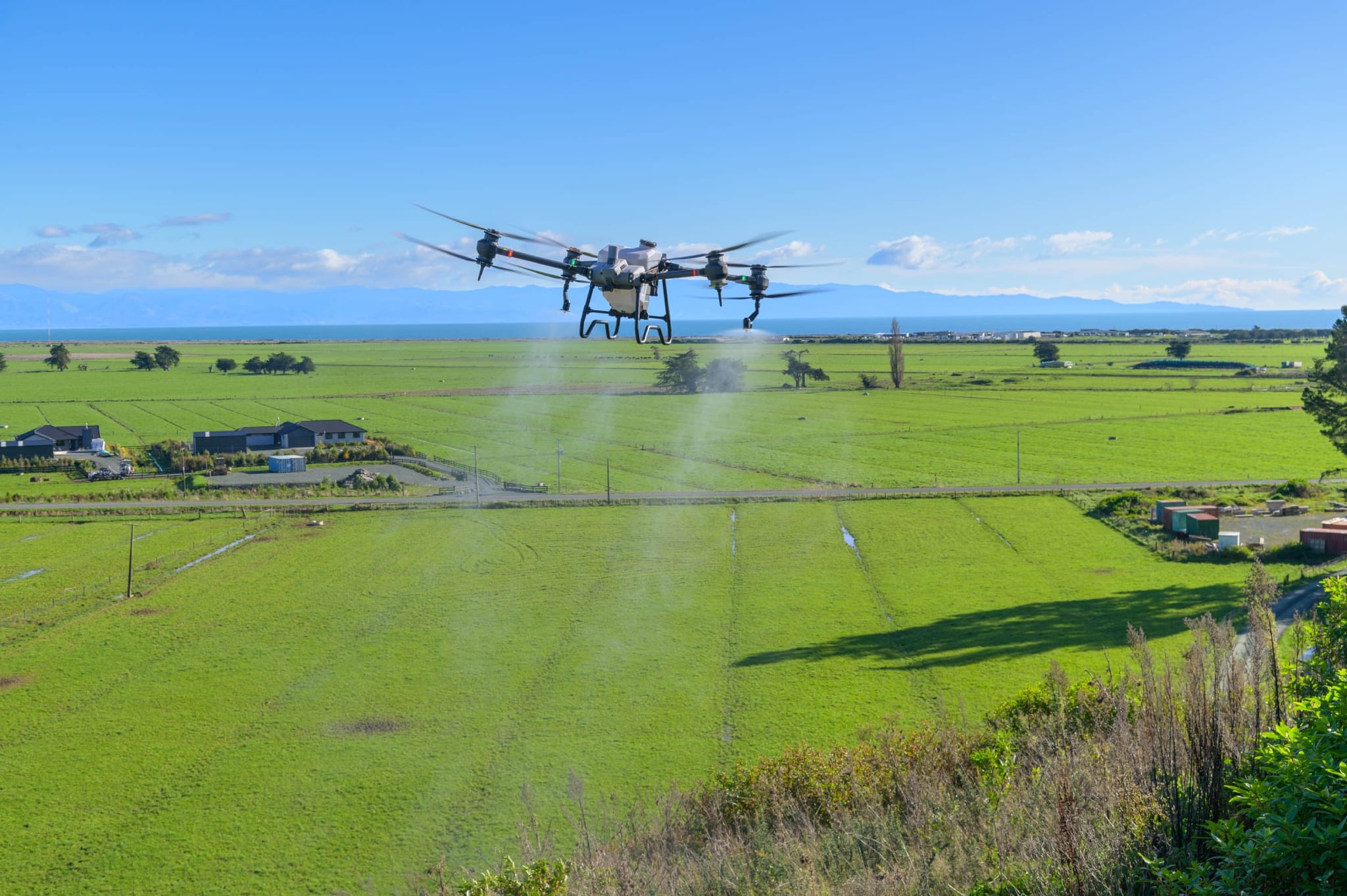
The cutting-edge aerial mapping drone services reduce the burden of the farmers
as it is handled by the capable hands of drone pilots.
As industries seek innovative solutions to sustainability, productivity, and other challenges, drone technology has become increasingly prevalent across various sectors. This growing prevalence has led to an expanding range of job opportunities for drone pilots in diverse fields.
One of the chief industries benefiting from drone technology is agriculture. Unpredictable weather, irrigation issues, pest control, and crop disease can significantly impact farm management and productivity. While traditional methods for addressing these challenges are still viable, they tend to be expensive, time-consuming, environmentally harmful, and overly complicated.
Understanding Aerial Mapping Services
What is the primary purpose of aerial mapping?
Aerial mapping offers an elevated perspective, enabling the collection of accurate and detailed geospatial information. This elevated perspective offers invaluable information to support a wide range of critical applications. It may include urban planning, disaster management, and precision agriculture.
Aerial mapping captures geospatial data from an aerial vantage point, using aircraft or specialised drones equipped with advanced cameras and sensors. This elevated perspective provides a comprehensive view of landscapes, structures, and natural features.
Concept of Aerial Mapping:
Aerial mapping utilizes high altitudes to collect data from locations that were once inaccessible. For example, drones can smoothly traverse extensive areas, capturing high-resolution images and collecting essential data. This data is subsequently used to create precise maps and three-dimensional models.
Precision and Accuracy:
The cornerstone of dependable mapping is precision and accuracy. Aerial mapping guarantees that maps and models closely reflect reality. This level of accuracy is crucial for making informed decisions across various sectors, effectively guiding progress and development.
Manageable solutions as to traditional practices:
How will the world produce enough food? How to feed the growing population in the face of the ever-increasing global demand for food? As the populace increments and accessible farmland diminishes! It turns out to be progressively challenging to concoct long-haul, manageable solutions as to traditional practices.
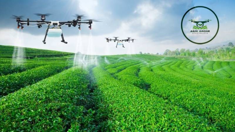
The answer, in the eyes of many, is precision agriculture. It employs advanced technology to boost crop yields and enhance profitability. It consumes less water and fertiliser than what is typically required to grow crops. Drone seeding services enable farmers to plant crops in more effective patterns. It is just an illustration to get more accuracy in the agriculture sector. The drone seeding services & drone mapping services do the work more efficiently and proficiently. It also saves your valuable time, labour costs & fuel.
Applications of Aerial Mapping in Precision Agriculture:
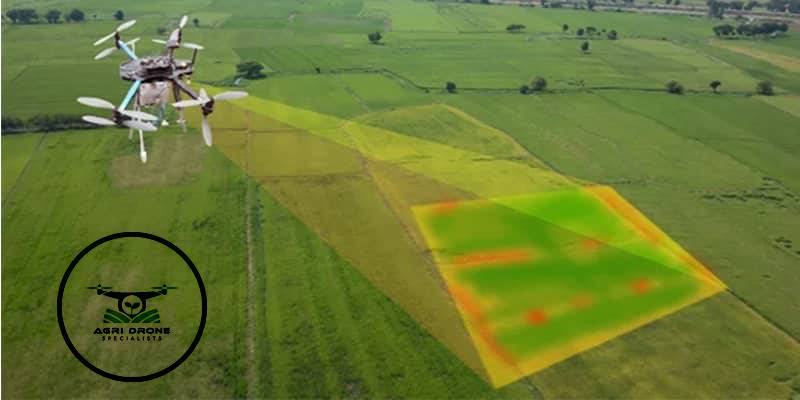
• Crop Health Assessment: Envision monitoring your crops’ health from above. Aerial mapping evaluates plant vigour, stress levels, and disease outbreaks, enabling farmers to take timely actions to safeguard their crops.
• Yield Prediction and Planning: Aerial mapping extends beyond the present, offering future forecasts. By analysing aerial data, farmers can predict yields, plan resources, and optimise harvest strategies.
• Irrigation Management: Aerial mapping optimises the use of water, a vital resource. Data from above assists farmers in planning precise irrigation methods, ensuring each plant receives the right amount of water, and promoting sustainable usage.
• Pest and Disease Detection: Early detection is crucial for preventing crop damage. Aerial mapping helps identify pests and diseases early, allowing for targeted treatments and protecting crops from potential harm.
Benefits of Aerial Mapping in Precision Agriculture:
• Increased Efficiency: Aerial mapping elevates efficiency. With precise data, farmers can make swift, informed decisions, boosting productivity and improving the bottom line.
• Resource Optimisation: Successful farming hinges on resource optimisation. Aerial mapping pinpoints areas requiring attention, allowing farmers to apply resources such as water, fertilisers, and pesticides with precise accuracy.
• Cost-Effectiveness: Resource savings translate to cost savings. Aerial mapping reduces costs by minimising waste, directing resources where needed, and avoiding unnecessary expenses.
• Sustainable Agriculture: Sustainability is essential. Aerial mapping supports sustainable agricultural practices by promoting efficient resource use, ultimately reducing farming’s environmental impact.
Discover Our Aerial Mapping and Agriculture Solutions:
At Agri Drone Specialists, we’re not just providing drone mapping services and drone seeding services; we’re pioneering a transformation. Our drone services for aerial mapping, spraying, and seeding provide more than just information! We forge a partnership for growth & progress. Opt for Agri Drone Specialists and embrace our efficiency. We help you step into the future of mapping in advanced agriculture practices. Your path to exceptional aerial mapping starts with us. Call us to discover more today!