Land management has always been key to urban development, agriculture, conservation and environmental sustainability. Traditional land surveying methods may be effective but they come with time constraints, labor intensive processes and accuracy limitations.
But drone mapping services have arrived and are changing the way land is measured, analyzed and managed. With the ability to capture high resolution aerial data quickly and efficiently, drones are revolutionizing land management by providing insights that inform decisions across various industries.
Accurate Land Measurements and Terrain Analysis
One of the biggest benefits of drone surveying is accurate land measurements and terrain analysis. Traditional methods require a lot of manpower and time, often resulting to errors and inconsistencies. Drones equipped with advanced GPS and LiDAR (Light Detection and Ranging) technology can map large areas with centimeter level accuracy.
Key Points:
• High Precision: Drones use GPS and photogrammetry to create topographic maps.
• Faster Data Collection: A drone can survey a large area in a fraction of the time it takes using traditional methods.
• Accessibility: Drones can access remote and hard to reach areas, reducing the risks associated with manual surveys.
• Cost Effective: Compared to conventional land surveying methods, drone mapping reduces operational costs by minimizing labor and equipment expenses.
By using drone technology, land managers, developers and environmentalists can get real time, detailed information of the land and make better planning and resource allocation.
Applications in Land Development and Planning
The real estate and construction industry are the biggest beneficiaries of drone mapping services. Accurate topographic surveys and 3D models generated by drones help architects, engineers and urban planners to visualize projects better.
Benefits in Development & Construction:
• Site Selection: Drones help identify suitable sites for construction based on terrain, drainage and accessibility.
• Project Monitoring: Developers can monitor construction progress remotely with regular aerial surveys.
• Infrastructure Planning: Drone data helps in designing road networks, utility placements and drainage system.
• Risk Mitigation: Identifying potential hazards before construction begins helps prevent costly mistakes and delays.
Drones simplify urban planning by providing land use assessment, making it easier for governments and private developers to design smarter and more efficient cities and communities.
Environmental Change and Erosion
Environmental monitoring is an area where drone mapping services are making big impacts. Climate change, deforestation and human activity cause big changes in the landscape, to the ecosystems and biodiversity. Drones are a cost effective and efficient way to monitor these changes over time.
Monitoring Environmental Changes and Erosion
Environmental monitoring is another key area where drone mapping services are making a big impact. Climate change, deforestation and human activities cause big changes in landscapes, affecting ecosystems and biodiversity. Drones provide a cost-effective and efficient solution for tracking these changes over time.
Key Applications:
• Erosion Monitoring: Drones capture aerial imagery to track soil erosion in coastal areas, riverbanks and agricultural lands.
• Forest Conservation: Conservationists use drone surveys to monitor deforestation and illegal logging.
• Wetland & Wildlife Protection: Drones help survey and protect fragile ecosystems, ensuring compliance with environmental rules.
• Disaster Response: After natural disasters like floods or landslides, drones assess damage quickly, guide relief efforts.
With high-res images and real-time monitoring, drones provide valuable insights that helps protect and restore natural environments.
Agricultural Land Management
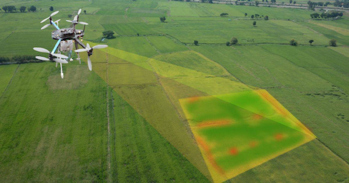
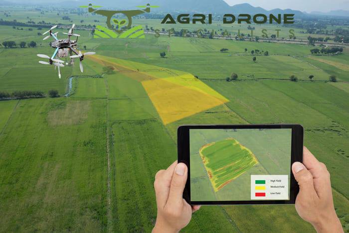
Agricultural sector is also benefiting from drone surveying technology. Farmers and agronomists use drone mapping services for precision agriculture, optimizing land use and crop management.
How Drones Helps in Farming:
• Soil Health Analysis: Drones capture data to determine soil quality and moisture levels.
• Crop Monitoring: Farmers can check crop health, detect diseases and identify areas that need irrigation or fertilizers.
• Irrigation Planning: Drones help design water distribution systems to reduce waste and increase yield.
• Livestock Management: Drone surveys provide insights into pasture conditions and monitor animal movement, ensure better resource allocation.
By integrating drone surveys in agricultural land management, farmers can make informed decisions that lead to higher productivity and sustainability.
Drones in Mining and Natural Resource Management
Mining companies and natural resource managers are also using drone surveying for resource exploration and site management. Drones provide detailed geological maps, monitor excavation sites and ensure compliance to safety regulations.
Benefits in Mining:
• Exploration: High-res mapping to identify mineral deposits.
• Safety Inspections: Drones minimize personnel to enter hazardous areas.
• Stockpile Measurements: Accurate volume assessment for inventory tracking.
• Regulatory Compliance: Drone data for environmental guidelines.
With increased efficiency and safety, drones are becoming a vital tool in responsible resource extraction and management.
Drone Surveying in Land Management
Things are moving fast in the world of drones. Artificial intelligence (AI) and machine learning are making drones even more powerful, with automated data analysis and predictive modeling on the horizon.
Future Developments:
• AI-Powered Image Analysis: Machine learning algorithms will interpret drone data, spot patterns and anomalies in the landscape.
• Autonomous Drones: AI-driven drones will do the surveys for you, saving time.
• Better Sensors & Imaging: LiDAR and multispectral imaging will get even more accurate terrain data.
• Cloud-Based Data Processing: Drone data will integrate with cloud platforms for real-time analysis and decision-making.
• Blockchain Integration: Secure and transparent data management for land transactions and environmental monitoring.
As drone surveying technology advances, so will its applications in land management. More precise and efficient solutions for industries worldwide.
Conclusion
From land measurement and development planning to environmental monitoring and agricultural optimization, drone mapping is changing land management like never before. By using drones, industries can save time, reduce costs and make better decisions.
Ready to use drone surveying for your land management? Get in touch with Agri Drone Specialists now to see how our drone mapping services can give you the precision and insights you need to make informed decisions. Let’s revolutionise land management!


